Journey into Surveying: Unravelling the Secrets of Existing Structures. This session, part of Mustafa Al-Adhami’s Lecture Series at Birmingham City University, focuses on BNV6133 Digital Design Practice with Existing Buildings for final-year students in Architectural Technology. It provides hands-on training in implementing Building Information Modelling (BIM) processes, emphasizing site survey techniques and material identification. Students survey the BCU School of Art, translating findings into detailed condition reports and 3D models using Revit. By the end, students excel in professional site surveying, as-built BIM data development, and synthesizing insights for comprehensive condition reports.
Introduction
Greetings, architectural enthusiasts! Today, we embark on a thrilling expedition into the heart of existing structures, a session brimming with innovation and tradition. Our second rendezvous in the BNV6133 Digital Design Practice with Existing Buildings module took our final-year architectural technology students on an exhilarating ride, introducing them to the art and science of surveying. With a blend of conventional wisdom and cutting-edge technology, this session was nothing short of a transformative experience.
Understanding the Fundamentals: An Overview of Surveying Principles
Our odyssey commenced with an exploration of the foundational principles of surveying. Delving into the meticulous world of measurements, we unravelled the secrets hidden within Historic England’s Drawing for Understanding. This treasure trove of knowledge illuminated our students on the art of Creating Interpretive Drawings of Historic Buildings, a skill that would serve as the bedrock of their surveying endeavours.

Guidelines and Beyond: Navigating the Terrain of Surveying
Armed with knowledge, our students delved deeper, immersing themselves in the nuances of surveying guidelines. Survey Photography, an essential aspect of modern surveying, was unveiled, allowing our aspiring architectural technologists to capture the essence of structures through their lenses.
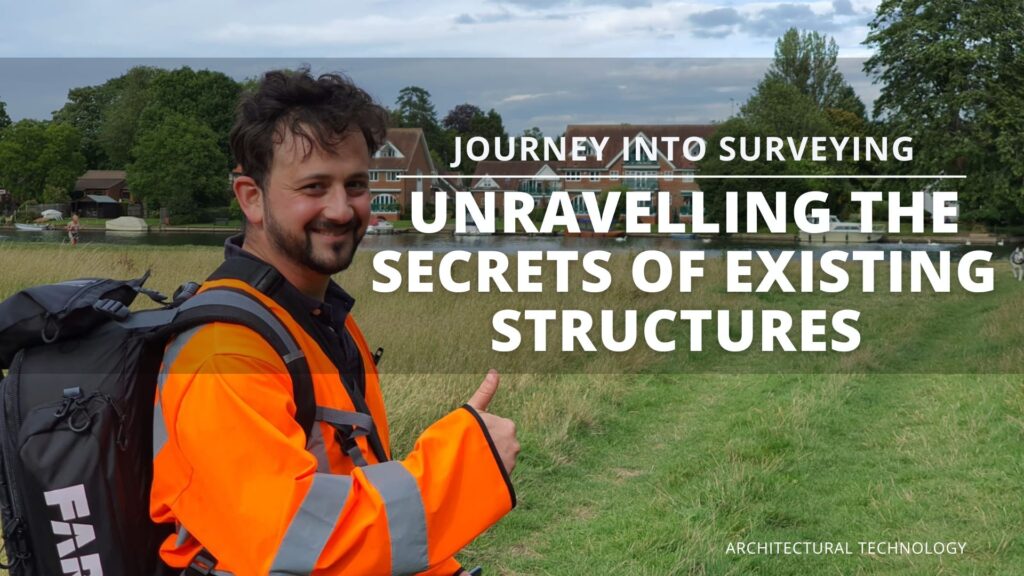
But before venturing into the field, meticulous preparation was essential. The session meticulously covered Site Survey Prep, emphasizing the importance of being meticulous and prepared before stepping foot on the site. The intricacies of Attending Site were explored, alongside the crucial aspects of procuring Permission Letters and ensuring Safety on Site.
The Art of Recording: Capturing the Essence of Structures
With boots on the ground and cameras in hand, our students discovered the art of Recording and Survey Notes. Through hands-on experience, they learned the delicate art of Measurements, understanding the importance of accuracy in the world of architectural surveying. Taking notes and understanding surveying symbols!


Review the Historic England guidance

Levelling the Playing Field: Mastering the Techniques
No surveying expedition is considered comprehensive without mastering the art of levelling. Under the guidance of our esteemed Visiting Lecturer, Gordon Cole, students delve into the intricacies of Setting-up and Using a Level. This crucial skill expands their perception, enabling them to analyse existing structures with the precision characteristic of experienced architectural technologists. Cole’s expertise empowers students, elevating their capabilities in the field of surveying.


Embracing Innovation: The Role of Technology in Surveying
In our quest for comprehensive understanding, we didn’t shy away from embracing innovation. Introducing our students to non-destructive surveying techniques such as laser scanning, drones, and advanced levelling methods, we empowered them with tools that are reshaping the architectural landscape. These cutting-edge technologies, seamlessly integrated into our curriculum, provided our students with a holistic perspective, preparing them for the challenges of the digital age.
Scan to BIM
the student had the opportunity to use advanced surveying tool, a laser scanner and scan the class room using Leica BLK360

Data collection
RAW from the scanner including 360 images and Lidar

Post Processing
- Process the raw data and create point cloud file in one of the default file format.
- Ensure we have a point cloud file compatible with Revit accepted file format for the next stage, BIM modelling.


BIM modelling
Overall modelling process
- Model import to BIM Tool (e.g. Revit)
- Preparing Grids & levels
- Wall Placement
- Column Placement
- Windows and Doors
- Roof Modelling
- Stairs
- Remaining details
- Save/Export


And there you have it – a glimpse into the riveting world of surveying in the BNV6133 Digital Design Practice with Existing Buildings module. As our students continue this exciting journey, they carry with them the wisdom of tradition and the promise of innovation. Stay tuned for more updates from our architectural adventure. Until then, keep surveying, keep innovating, and keep building the future!
Happy Surveying!
